
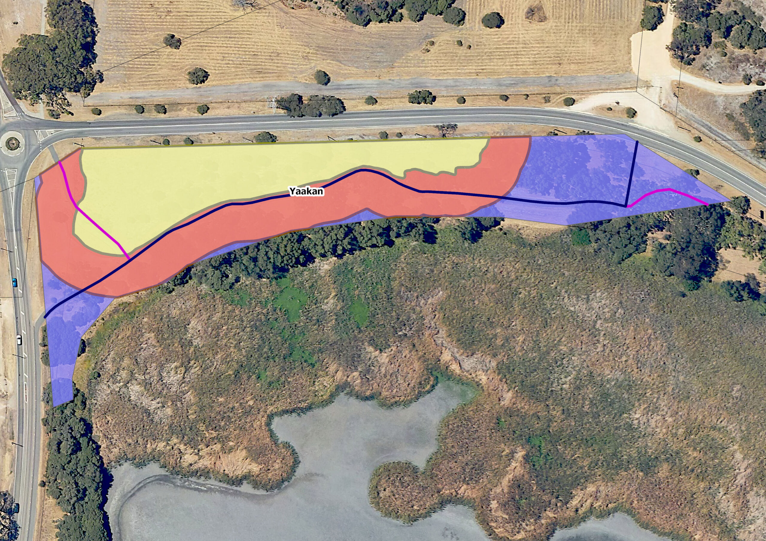
Beneath the soil surface, near the shores of Walliabup (Bibra Lake), are the artefacts of Nyungar people who first camped by the lake, using its rich resources for food and shelter. An archaeological investigation commissioned by Rehabilitating Roe 8 in 2020 discovered tools made from fossiliferous chert not available since the last ice age, demonstrating that the land between Walliabup and Coolbellup (North Lake) has been occupied for many thousands of years. Nyungar families continued to camp in the area until the 1960s and they still maintain a strong connection to this land. Much of the original vegetation at Yaakan (snake-necked turtle) corner has been cleared since European settlement, replaced with introduced species to create a parklike landscape for recreational activities. In places, bibool (paperbark) and yanget (club rush) still fringe the lake. There are complex hydrological connections between Walliabup and the wetlands immediately to the north which include Horse Paddock Swamp and Coolbellup Lake.
Yaakan
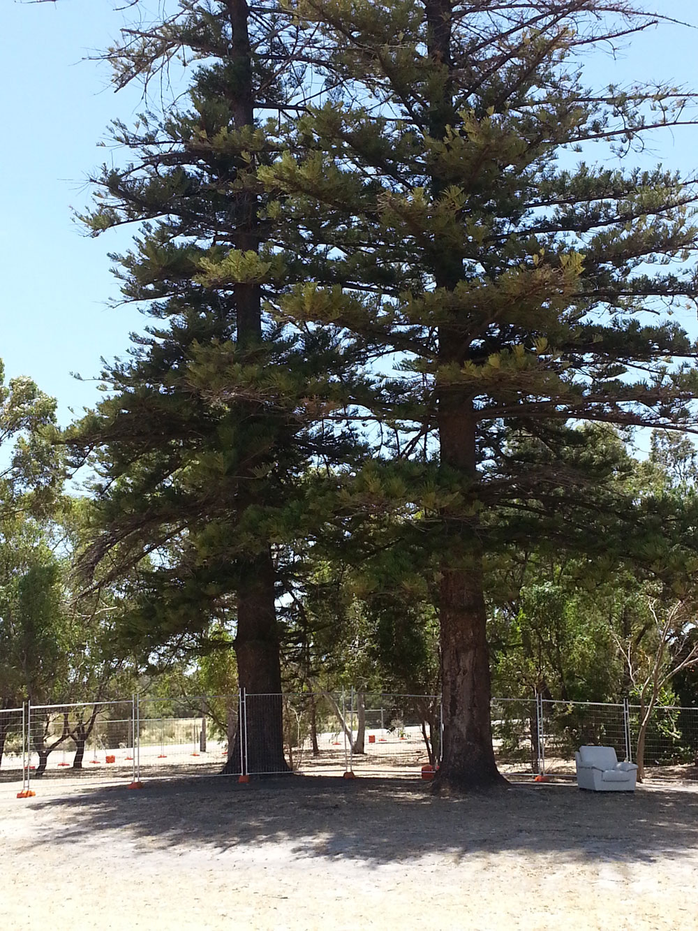
Norfolk pines planted by settler John Dixon (Photo: D. Brady)
The sandy, gentle slope away from Walliabup toward the damplands of Horse Paddock Swamp is favoured by yaakan, the snake-necked turtle (Chelodina oblonga), when they leave the lake to nest. They dig into the sand with their hind legs and lay their eggs in a shallow pit toward the end of kambarang (second spring in the Nyungar Six Seasons. The pressures of urbanisation, including car traffic, loss of fringing habitat and introduced predators, has greatly reduced the numbers of yaakan successfully reproducing. The roads that ring Walliabup are an impediment to the movement of turtles between the wetlands and the lake. The Saving Our Snake Necked Turtle Project aims to arrest this decline by involving researchers and citizen scientists in tracking nesting turtles over time using TurtleSat.
At Yaakan there are traces of the first European settlers who were drawn to Walliabup for the fertile soil and access to water. Market gardeners, firewood cutters and dairy farmers were early European users of the area. John Dixon (Jnr) was the son of a Parkhurst boy (a juvenile migrant transported to WA) who established a small farm near Walliabup. Two Norfolk Island pines on the shore of the lake are believed to have been planted by John Dixon (Jnr), just outside his house, to celebrate his marriage to Eliza Bale in 1888. Some of their descendants still live in Cockburn today. In the 21st century the pines were a distinctive feature of the intersection of Hope Road and Progress Drive and recorded on the Cockburn Heritage Register
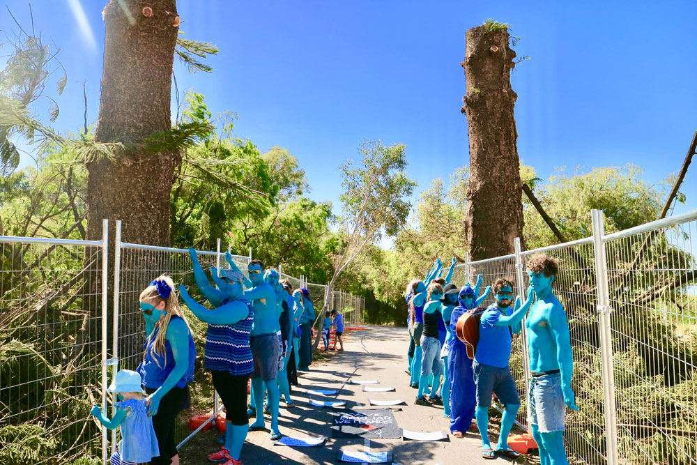
“Blue for the love of Beeliar” protest near the Dixon pines 2017 (Photo: Lehani Ani)
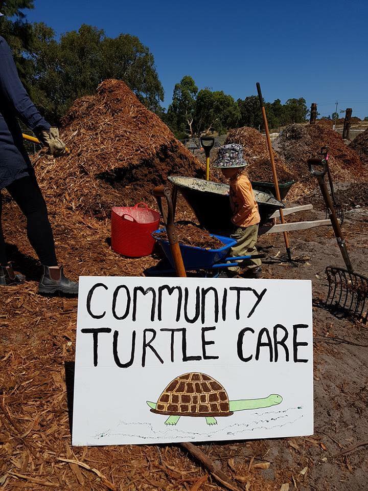
Removing mulch from Yaakan corner 2017 (Photo: Rethink the Link)
The 1960s Metropolitan Regional Scheme planned Roe Highway Section 8 to cut between the wetlands and Walliabup. When clearing for construction commenced in 2017, John Dixon’s pines that had stood for over one hundred years were lopped at an early stage of work when they did not pose any impediment to other clearing. Environmental activists from the local community and across Perth protested at Yaakan, trying valiantly to stop the clearing. After the section was cleared, it became a storage site for huge piles of mulched vegetation. Following the cessation of the Roe 8 project in March 2017, community members agitated to have these mulch piles removed least they affect turtle hatching and assisted to spread out the mulch. In 2023, woody meadow plantings as part of the Rehabilitating Roe 8 project promised a reimagining of this significant natural/cultural site.